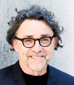
John P. Wilson
Director, USC Spatial Sciences Institute
Professor of Spatial Sciences and Sociology
• GIS • spatial analysis • environmental modeling
• geodesign • mapping • public health
Director, USC Spatial Sciences Institute
Professor of Spatial Sciences and Sociology
• GIS • spatial analysis • environmental modeling
• geodesign • mapping • public health
University of Southern California
Professor, Department of Sociology, Dornsife College of Letters, Arts and Sciences
Adjunct Professor, School of Architecture, and Departments of Civil & Environmental Engineering and Computer Science, Viterbi School of Engineering
Director, Spatial Sciences Institute, GIS Research Laboratory, and Geographic Information
Science & Technology Graduate Programs
Co-Leader, GIS and Exposure Facility Core, Southern California Environmental Health
Sciences Center
Visiting Professor (Thousand Talents Program), Institute of Geographical Sciences and Natural
Resources Research, Chinese Academy of Sciences
Editor, Transactions in GIS, Blackwell-Wiley
Take a look at John Wilson’s
Dr. John P. Wilson is Professor of Spatial Sciences and Sociology in the Dana and David Dornsife College of Letters, Arts and Sciences at the University of Southern California (USC) where he directs the Spatial Sciences Institute as well as the Geographic Information Science & Technology (GIST) Graduate Programs and GIS Research Laboratory, and also holds adjunct appointments as Professor in the School of Architecture and in the Viterbi School of Engineering’s Departments of Computer Science and Civil & Environmental Engineering.
From 1998 to 2001 and 2007 to 2010 he was Chair of the Department of Geography at USC, and from 1992 to 1997 he was Professor of Geography in the Department of Earth Sciences, Adjunct Professor of Soil Science in the Department of Plant and Soil Science, and Director of the Geographic Information and Analysis Center (GIAC) at Montana State University (MSU). His early career was as Assistant Professor (1984-1990) and then Associate Professor of Geography (1990-1994) with corresponding adjunct appointments in Plant and Soil Science at MSU. He founded GIAC at MSU in 1989 and the GIS Research Laboratory, GIST Graduate Programs, and Spatial Sciences Institute at USC in 1997, 2007 and 2010, respectively. He has held several visiting appointments in environmental studies, geography, and planning at the Australian National University, University of Canterbury, University of Utrecht, University of Waikato, and most recently, in the Institute of Geographical Sciences and Natural Resources Research at the Chinese Academy of Sciences.
He founded the journal Transactions in GIS (Wiley-Blackwell) in 1996 and has served as Editor-in-Chief since its inception. He has served on the editorial boards of Applied Geography (1992-2001), the Annals of the Association of American Geographers (2006-2009), the Journal of Geo-Spatial Information Science (2011-present), and the Annals of the Association of American Geographers Review of Books (2013-present). He has chaired the Applied Geography Specialty Group of the Association of American Geographers (1989-1991) and Research Committee of the University Consortium for Geographic Information Science (UCGIS) (2002-2005). He also served on the Board of Directors (2003-2006) and as President of UCGIS from 2006 to 2007. He currently leads the UCGIS GIS&T Body of Knowledge 2.0 project and is an active participant in the UNIGIS International Network, a worldwide consortium of 10+ institutions which collaborates on the development and delivery of online geographic information science academic programs.
His research is focused on the modeling of human and environmental systems and makes extensive use of GIS tools, spatial analysis techniques, and computer models. He has published numerous books and articles on these topics, including two edited volumes, Terrain Analysis: Principles and Applications (John Wiley and Sons, 2000) and the Handbook of Geographic Information Science (Blackwell Publishers, 2007). Much of this work is collaborative and cross-disciplinary in character with the general goal of improving our knowledge and understanding of the factors linking people, their environments, and human health. The work of his group can be seen on the website http://spatial.usc.edu/. He has received numerous honors for his research and teaching, the most recent being recognized as a Fellow of the University Consortium for Geographic Information Science (2014), Special Achievement in GIS Awards for Geospatial Teaching (2008) and Leadership with Geospatial Technology (2006), a Mellon Award for Excellence in Mentoring from the Center for Excellence in Teaching at USC (2005) and the Albert S. Raubenheimer Outstanding Faculty Award for his research, teaching, and service contributions in Dornsife College at USC (2004).
3 edited books
26 book chapters (7 co-authored with students)
66 refereed journal articles (33 co-authored with students)
21 conference/symposium proceedings papers (9 co-authored with students)
41 technical reports and working papers (26 co-authored with students)
170 presentations at conferences and symposia (60 co-authored with students)
12 webinars
67 invited lectures and seminars
111 grants and contracts worth $8,200,814 (32 internal, 79 external)
6 post-doctoral fellows and visiting scholars supervised
12 Ph.D.s graduated (10 in Geography; 2 in Computer Science)
28 M.A./M.S.s graduated (14 in Geography; 12 in Geographic Information Science & Technology; 1 in Geology; 1 in Soil Science)
1980s | 1990s | 2000s | 2010s | Totals | |
---|---|---|---|---|---|
Books & Book Chapters | 3 | 7 | 14 | 4 | 28 |
Refereed Journal Articles | 8 | 19 | 25 | 14 | 66 |
Conference / Symposium Proceedings Papers | 1 | 10 | 4 | 6 | 21 |
Conference / Symposia Presentations | 19 | 65 | 49 | 37 | 107 |
Technical Reports & Working Papers | 4 | 2 | 31 | 3 | 41 |
Webinars | – | – | – | 11 | 11 |
Invited Talks & Seminars | 6 | 23 | 16 | 22 | 67 |
PhDs Graduated | – | – | 5 | 7 | 12 |
MAs & MSs Graduated | 2 | 11 | 3 | 12 | 28 |
No. of Grants & Contracts Awarded | 12 | 45 | 38 | 16 | 111 |
Total Grant & Contract Dollars | $273,459 | $2,905,868 | $4,293,255 | $728,232 | $8,200,814 |
Building Things That Matter:
I moved to the University of Southern California in 1997 and founded the GIS Research Laboratory that I have directed from its inception to the present-day. The field has changed a great deal in the past 20 years and the lab has changed with it. Hence, much of our work today is focused on web services and mapping as well as various kinds of spatial modeling because some of the early tasks (like building geospatial datasets has (fortunately) that took tremendous time and effort have faded into the background).
The field of geographic information science has grown tremendously in terms of both breadth and depth during this period. The work of pioneers (like Luc Anselin, Peter Fisher, Michael Goodchild, and Shaowen Wang, among others) along with the emergence of the spatial turn – which has swept through the natural sciences, the social sciences and the humanities – and computational advances spawned by colleagues in both the computer science and information technology fields has helped to spawn this growth. Whatever the explanation, I personally have come to view geographic information science as an enabling discipline (much like statistics has become during my lifetime) and with this in mind I founded the USC Spatial Sciences Institute on 1st July, 2010.
Housed in the Dana and David Dornsife College of Letters, Arts and Sciences, the USC Spatial Sciences Institute looks outward and endeavors to promote and support spatial ways of knowing across the academy. I believe that there many scholars and students across a swath of disciplines who would benefit from looking at their topics through a spatial lens from time to time and so we need academic programs that simultaneously introduce large numbers of scholars and students to the spatial sciences on the one hand and train relatively small numbers of spatial scientists on the other hand! The new academic programs I have crafted seek to achieve both of these outcomes – as is explained below.
The launch of the Spatial Sciences Institute on 1st July, 2010 followed several years of planning and the goal was to create a nimble, outward looking academic unit that could seize a number of opportunities to build a series of interdisciplinary academic degree programs and then create the technological and intellectual base to support these programs.
I started by writing curriculum and accreditation proposals to launch an online M.S. in Geographic Information Science & Technology (GIST) to complement an online Graduate Certificate I had designed and launched in 1998 soon after joining the USC Department of Geography. The new GIST M.S. has flourished since the first students were recruited in Fall Semester 2010 and we have recently added new Graduate Certificates in Geospatial Intelligence and Geospatial Leadership as well as a GeoHealth track in the Keck School of Medicine’s online Master of Public Health (MPH) degree program. We have already graduated 60 GIST M.S. degrees and 200 GIST Graduate Certificates and we continue to explore pathways that would extend our reach across complementary disciplines and application domains.
I next started thinking about and designing an interdisciplinary B.S. in GeoDesign degree program. Encouraged by the success of the online programs and realizing that geographic information science (and my own work for that matter) had spent too much time and effort focused on describing and explaining what was wrong with the world, I was lucky enough to attend a presentation by Carl Steinitz at Esri in 2011 and it got me thinking about what one would need to do to create undergraduate degree programs that would help students think of solutions (as well as problems) and simultaneously help them to select their career and graduate education goals. The new B.S. in GeoDesign degree launched in Spring Semester 2014 draws roughly equal amounts of material from architecture, planning and the spatial sciences, and is the first degree of its kind in the world. The concept is simple – the School of Architecture leads the design elements of the program, the Price School of Public Policy provides the planning frameworks around which both collective and individual action (creativity) can be promoted and sustained, and the USC Spatial Sciences Institute provides the spatial platform or stage on which scientific knowledge is gathered and assembled to address the opportunity at hand. The student response has been fantastic and we currently have 15 geodesign majors just a year out from the official launch of this exciting new interdisciplinary degree program. The future is promising – with the second geodesign class scheduled with UNIGIS colleagues in Europe this May and a new collaborative classroom scheduled for completion by the end of Summer Semester, 2015.
I am now busy putting the finishing touches on curriculum proposals and the various administrative tasks that will be needed to launch a new interdisciplinary Ph.D. in Population, Health and Place in Fall Semester, 2016. Built on roughly equal contributions from the Department of Preventive Medicine, the Department of Sociology, and the Spatial Sciences Institute this new degree program will aim to produce a new kind of scholar and leader – one who is cross-trained in public health (biostatistics, exposure science, epidemiology, etc.), sociology (population science, social capital, etc.) and the spatial sciences (mapping, spatial analysis and modeling) and thereby positioned to help find and implement solutions for the world’s most complicated and enduring challenges and opportunities related to environmental sustainability, social justice and human well-being. This new program, which will be administered by the Spatial Sciences Institute and leverage its rapidly evolving and expanding computational platforms, may well be the first program of this type in the world and the challenge will be to build it out in ways that spawn new and substantial collaborations among the new PHP doctoral students on the one hand and the participating faculty, post-doctoral fellows, and undergraduate students on the other hand. I look forward to leading this effort and are thankful to Deans Steve Kay (Dornsife College) and Carmen Puliafito (Keck School of Medicine) for the support they have committed to this effort.
Building Successful Collaborations
The best collaborations are those where the sum of the parts is more than the parts themselves. These opportunities occur in a variety of ways but the best usually involve faculty colleagues and students, as explained below
Working with Faculty Colleagues
A quick glance at my publications will indicate that I have been lucky enough to work with many wonderful colleagues over the years. Indeed, there are too many to mention by name, but let me say that I have come to realize in the past couple of years that my role in such collaborations is changing quickly. I chose to go to Montana State University in 1984 because I loved the landscapes and I saw tremendous opportunities to gather expertise and guidance from a trio of senior faculty – Steve Custer, Gerry Nielsen, and Robert Taylor. Each was influential and all three played key roles in my early successes in both fundraising and publishing. My hope is that I gathered sufficient knowledge and wisdom over the past 30 years that I might switch my role in these kinds of collaborations going forward – one in which I assume the role of senior scholar and guiding hand and seek out young scholars like Jordy Hendrikx (Department of Earth Sciences, Montana State University) and Kelly Sanders (Department of Civil and Environmental Engineering, University of Southern California) to build new and novel collaborative research projects.
Working with Students
A quick glance at my publications will indicate that I have also published many book chapters, journal articles, and conference proceedings papers with graduate students over the past three decades. I chose an academic career so I could work with students and the “value proposition that has accompanied this choice gets better with the passage of time. I have never tired of teaching nor guiding student research projects and look forward to many new opportunities to do this using the new degree programs we have created in the USC Spatial Sciences Institute in the years ahead.